Understanding Place was funded by National Science Challenges: Building Better Homes, Towns and Cities.
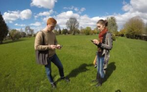
This project gathers and shares resident and manawhenua stories about the residential red zone in Christchurch, Aotearoa New Zealand on a mapping platform, with analytical tools to help people explore each other’s material. The platform is available via an app and a permanent website. The project allows people in the city to record their thoughts about places in a 600-hectare area that was cleared of houses after the 2011 Canterbury earthquake. At the same time it provides urban planners with a lens through which to view the land – as residents see it. The project also contributes to the university’s QuakeStudies archive – already the largest post-disaster digital repository we know of.
The base layer on the map is the manawhenua story of the awa (river) and surrounding area, told by Prof Maire Tau, upoko of Ngāi Tūāhuriri and director of the Ngāi Tahu Research Centre in a series of videos. Other layers contain people’s memories of living in the area and the ways that people use the red zone now. We want to enable people to convey their rich connections with spaces and places through photography, video, audio, and text, expressing their memories, thoughts or hopes about former homes and suburbs, the river and the land. The interactive digital map is designed to give people a space to reflect on and consider what the area means to them.
What is the residential red zone?
Seven years on from the 2011 Canterbury earthquakes, a 600-hectare area of land that once housed 5000 people, called the Flat Land Residential Red Zone (RRZ), has been cleared of nearly all buildings. The future of this land, stretching from the four avenues of the CBD to the Avon-Heathcote Estuary, still remains uncertain. In recent years, there has been much discussion around plans for the future use of the RRZ. Organisations such as Avon-Ōtākaro Network and Regenerate Christchurch have been key players in these discussions and have presented a number of crowd-sourced visions for what the future could look like. As those plans develop, this project ensures that manawhenua and resident relationships to the place stay in the foreground.
Telling micro-stories of place
The project has implications for urban planning. There are high expectations now that planning processes will take account of a range of views and will include residents. This project aims to provide one model of how to do that, by mapping the meaning of place that arises from people’s own responses. The tools developed here can be used also to underpin planning for climate change adaptation, new infrastructure and community development.

However, Understanding Place is not directly a consultation tool. It sits in between urban planning public consultation, volunteered geographical survey and cultural archiving. It takes its lead from the open approach of Presner, Shepard, and Kawano (2014) in their book HyperCities: Thick Mapping in the Digital Humanities. Rather than prompt residents about particular issues or places they simply ask: “Where are you from? What used to be here?” As well as emphasising personal storytelling, the project brings those stories together in a cultural map, where personal and collective memories talk to one another. Giannachi (2016) terms projects like this “Archives 3.0”, because the archive becomes an active and citizen-led process rather than a static repository. Understanding Place seeks to provide both a repository of community stories and a set of tools for visualising peoples’ connections to this landscape. The goal is to add to the layers of memory and history in this part of the city.
What’s your connection to the Red Zone?
The data gathering phase of Understanding Place has now ended. Thank you to everyone who shared their stories!
Researchers
Associate Professor Donald Matheson, Lead Investigator
Professor Paul Millar, Associate Investigator
Development and Outreach
Kaspar Middendorf, UC Arts Digital Lab Manager
Jenny Rees, Digital Projects Specialist
Samuel Hope, Digital Projects Specialist
Jonathan Hunt, Catalyst IT
Satoshi Sugimura, Catalyst IT
James Hurren, Summer Intern
Hannah Turner, Summer Intern